Village History
Upper Nyack’s location on the west shore of the Hudson River and immediately south of Hook Mountain has influenced every era of the Village’s history. The industries and methods of transportation that have been historically linked to the river, along with the majestic views the river and the mountain provide, have uniquely shaped Upper Nyack.
And because the Village is bounded on the east and north by these two great natural resources, the Village’s two primary streets, North Broadway and North Midland Avenue, are not typical through streets. This geographical factor has spared Upper Nyack from the drive-through, automobileoriented, commercially focused pattern of land use development prevalent in the region.
With these natural boundaries, and the dominance of the downtown business district of the Village of Nyack for all the Nyack riverfront villages, Upper Nyack has always been, apart from the western edge of the Village that Route 9W traverses, more residential and less commercial in its basic character.
Indigenous People
The Nyack area was traditionally part of the territory of the Tappans, a related group of Algonkian-speaking Lenape (see Native Lands interactive map). Members of the Nyack tribe had been here for only a few generations, having been displaced from their long-time home in Coney Island by Dutch purchase and settlement. The indigenous people left this area very quickly after selling the land to the Dutch, leaving no record of assimilation or intermarriage with the white settlers. European diseases and alcoholism took a heavy toll on these indigenous people, and most moved west or north with other Lenape tribes. The existing names and pictograph signatures of those who signed the deed, and the collections of arrowheads, axes, and pottery fragments that have been found give us hints about their way of life, but lacking a written history, most of the story of the indigenous people who originally occupied this area is lost.First Settlers
The first European and African-born settlers of what is now the Village of Upper Nyack were Cornelius Clausen Kuyper, his family, and his enslaved workers. They came here from Jersey City in 1686 to make their home on what was a royal patent acquired by Kuyper’s father, Claus Jensen von Purmerant, in 1671. The title to the area had been purchased from the Native Americans by Balthazar deHarte.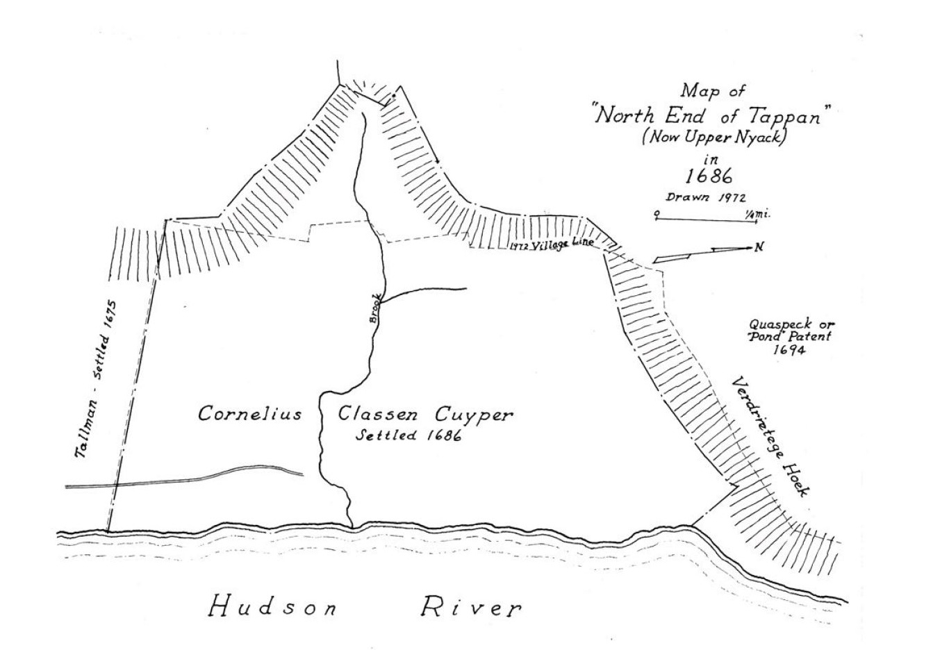
Cornelius Kuyper thrived in Upper Nyack on a farm of over 2000 acres. He was
illiterate, spoke Dutch, and signed his name with an ‘X’, but despite his literary
handicap, he became a Justice of the Peace, Colonel in the Militia and a member of
the New York Colonial Assembly. He also acquired other land in the county and at
his death left each of his children a substantial farm in accordance with Dutch
custom.
Life continued based largely on rural Dutch customs for about 100 years in this remote part of a British colony. Transportation was primarily by sailboat, and to a limited extent by horseback or horse and wagon. Each farm was nearly selfsufficient, and most farmers owned a traditional Dutch sloep (sloop) to take produce to market in New York City. On Sundays, families traveled by horse and wagon to Dutch Reformed Churches in Tappan or West Nyack.
The Revolution
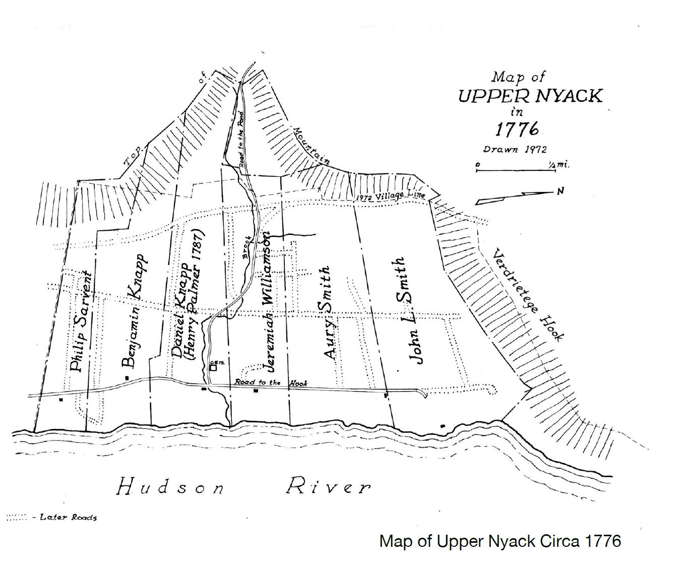
By 1776, Upper Nyack still consisted of six farms owned by descendants of the original settlers. There is no record of Upper Nyackers serving in the Continental Army or Navy during the Revolution, but most of the farmers joined the Shore Guard militia under the command of Colonel Ann Hawkes Hay. The Shore Guard had two majors - both named John Smith - one of whom owned the farm closest to Hook Mountain, with a stone house near the River. The house was burned by the British, rebuilt soon after, and lost to demolition in the 20th century. A wood-framed wing on the north side of the current house replicates the shape and location of the original. John Smith’s brother Aury was a captain in the Shore Guard militia and owned the next farm to the south. The mission of the Shore Guard was to repel landing parties from British ships that controlled the lower Hudson River. These British marauding parties searched for and captured men of military age, taking them to prison in New York City, and confiscated cattle and produce to feed the British army and civilians in the city. A watch fire on top of Hook Mountain was used to call out the Shore Guard militia, who attempted to hold off the British marauders with a swivel gun on Major Smith’s property and musket fire from Sarvent’s Quarry near the future south boundary of the village. A pile of soil and tailings from the quarry, still there today, became a makeshift fort to shelter the militiamen as they shot at the British soldiers approaching the quarry dock in landing boats. History books credit the locals with turning back the British raiders with heavy casualties.Growth During the Early Republic
Farming remained the main source of livelihood in the decades following the Revolution, but there were signs of other economic activity. The Benjamin Knapp farm, extending from just north of Castle Heights Avenue to just north of Old Mountain Road, was subdivided into five parts and sold outside the family with John Van Houten acquiring the southernmost part including the landing at the foot of Van Houten Street. There he began a boat-building business and opened a small hotel to accommodate river travelers. Quarrying of the local red sandstone was carried out near the shore on almost every farm. The extent of quarrying created a demand for sloops to transport the stone and many were built at the Van Houten boatyard and at adjacent boatyards owned by John Felter to the south and Daniel Perry to the north. Altogether, boatyards in the Nyacks produced more Hudson River Sloops, by far, than any other community on the river. There was a brief period around 1800 when backers thought that “Nyack’s Upper Landing” might become the main business nucleus of the Nyack community. It had a busy dock with a hotel and even a post office. Sloops offered frequent, if somewhat unreliable, transportation to New York City. More important it had the only viable road to the interior of the county. Then called the “road to the pond”, Old Mountain Road and Christian Herald Road led over the mountain to King’s Highway, which in turn connected with Old Mill Road, Germonds Road and other early byways. By contrast, travel westward from the lower part of Nyack was blocked by the West Nyack Swamp.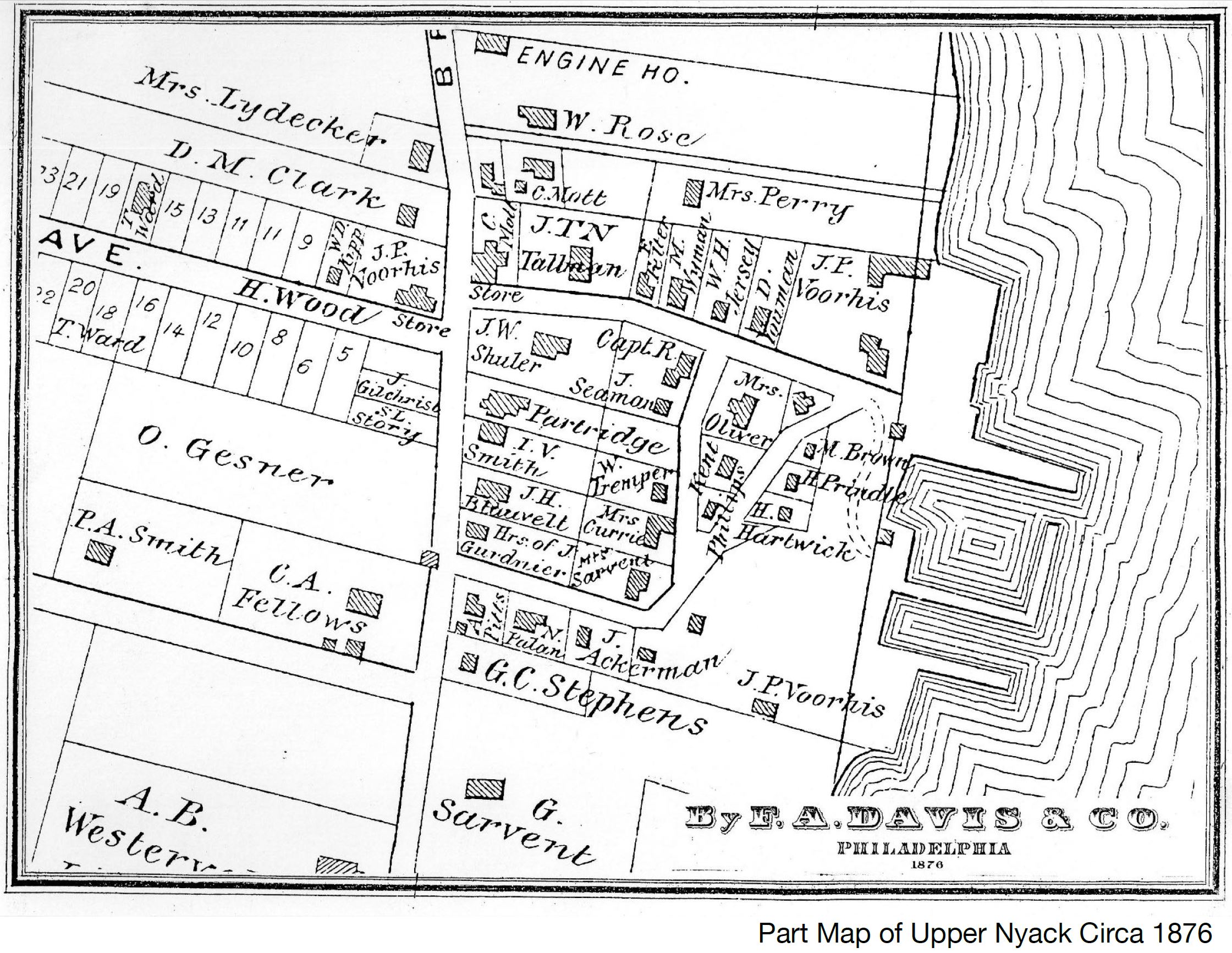
As the 19th century progressed, the pace of economic activity in the community accelerated. With the beginning of regular service on the steamboat Orange in 1829 and the opening of the Nyack Turnpike in the early 1830s, it became evident that the area to the south, the future Village of Nyack, would become the business hub of the community, not Nyack’s Upper Landing.
Farming continued in Nyack’s Upper Landing while homes were built in the neighborhood around the boatyard between 1825 and 1850 for ship captains, shipyard owners, ship carpenters, and other small businessmen and their families.
The Railroad and Country Estates
As agriculture in the rest of the country became mechanized and gained fast access to markets by railroad, the 15 or so small narrow farms of less than 50 acres in Upper Nyack became unable to compete profitably. When the railroad came to Nyack in 1870 making convenient commuting possible, these farms became desirable riverfront or river-view estates for bankers, lawyers, stockbrokers and business owners with positions in New York City.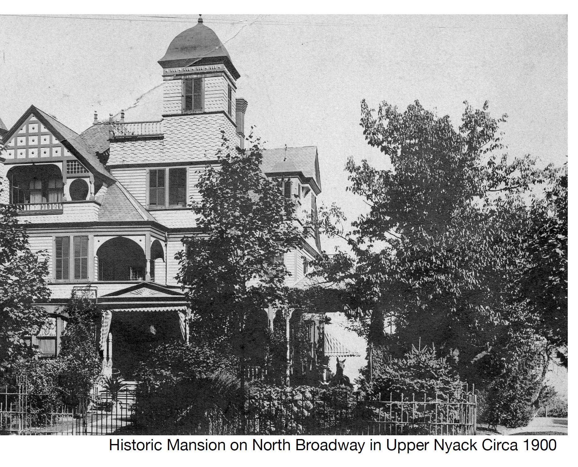
Many had a horse and carriage with driver for the trip to the station and could be on Wall Street in an hour and a half. Large handsome mansions set well back from North Broadway were built and many remain today. Some were year-round residences, while others were closed during the winter. In the boom periods of the 1890s and 1920s even grander mansions replaced some earlier residences. While they have always been a minor part of the population, these wealthy estate owners created an aura for Upper Nyack that extended to the entire community. Notably, the growth of more modest homes also accelerated during the same periods.
Incorporating a Village
In 1872, with the State of New York having recently passed legislation providing for the incorporating of villages, there was a movement to incorporate the entire Nyack community, from Salisbury Point to Hook Mountain, as a single village. Anticipating heavy taxes under the proposed single village concept in order to pay for the expenses of the downtown Nyack area, a committee of Upper Nyackers acted quickly and on September 28, 1872 the separate Village of Upper Nyack was incorporated, just days before the incorporation of the rest of Nyack.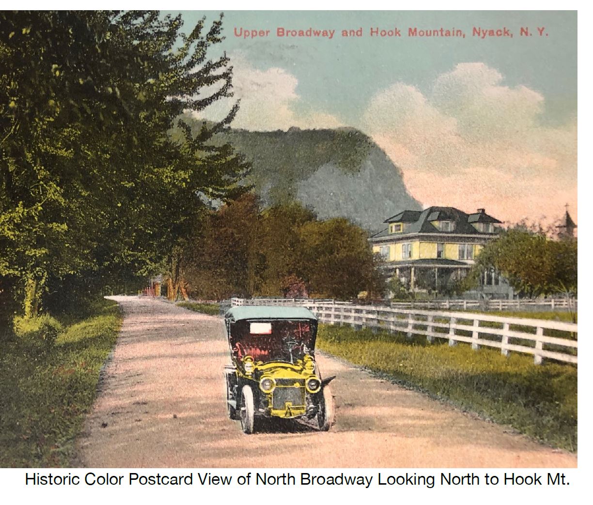
Garret Sarvent, owner of the southernmost farm in Upper Nyack and whose family had lived here since 1748, was chosen as President and served for 17 years. For the first 65 years the elected head of the village was known as the President, but in 1937 the title was changed to Mayor. Some 15 people have served as President or Mayor since the Village was incorporated, with hundreds more serving as Trustees, Village Attorney, Village Justice, Village Clerk, Assessor, and members of the land use boards.
Growth of Neighborhoods
The Village of Upper Nyack and its residential neighborhoods grew gradually over the years, with occasional periods of more intense activity. Highmount Avenue started as the Sarvent farm lane and was built up little by little from 1850 to 1960 as larger lots were subdivided and the former school playground was developed. The row houses on School Street were built around 1885. (For further information see also Section 8: Special Districts & Historic Landmarks). Castle Heights Avenue was platted with lots in 1872 and homes were built over a 50-year period. The homes on Birchwood Avenue east of Midland Avenue were built in the 20th century (except for one very old house on the corner of Broadway). Old Mountain Road, a much older thoroughfare, with few exceptions did not have houses until the 20th century.Upper Birchwood Avenue and the streets intersecting it were part of a large development project on the western end of the former Palmer farm whose one hundred-plus small lots offered for sale in the latter part of the 20th century was intended to be affordable to a broad spectrum of middle-class families. In the northern half of the village long narrow parcels of former farmland that were subdivided were built upon one by one at intervals during the 20th century and into the next. With the exception of a few estates and some remaining farm buildings, most homes date from the 1920s or the 1950s to the present.
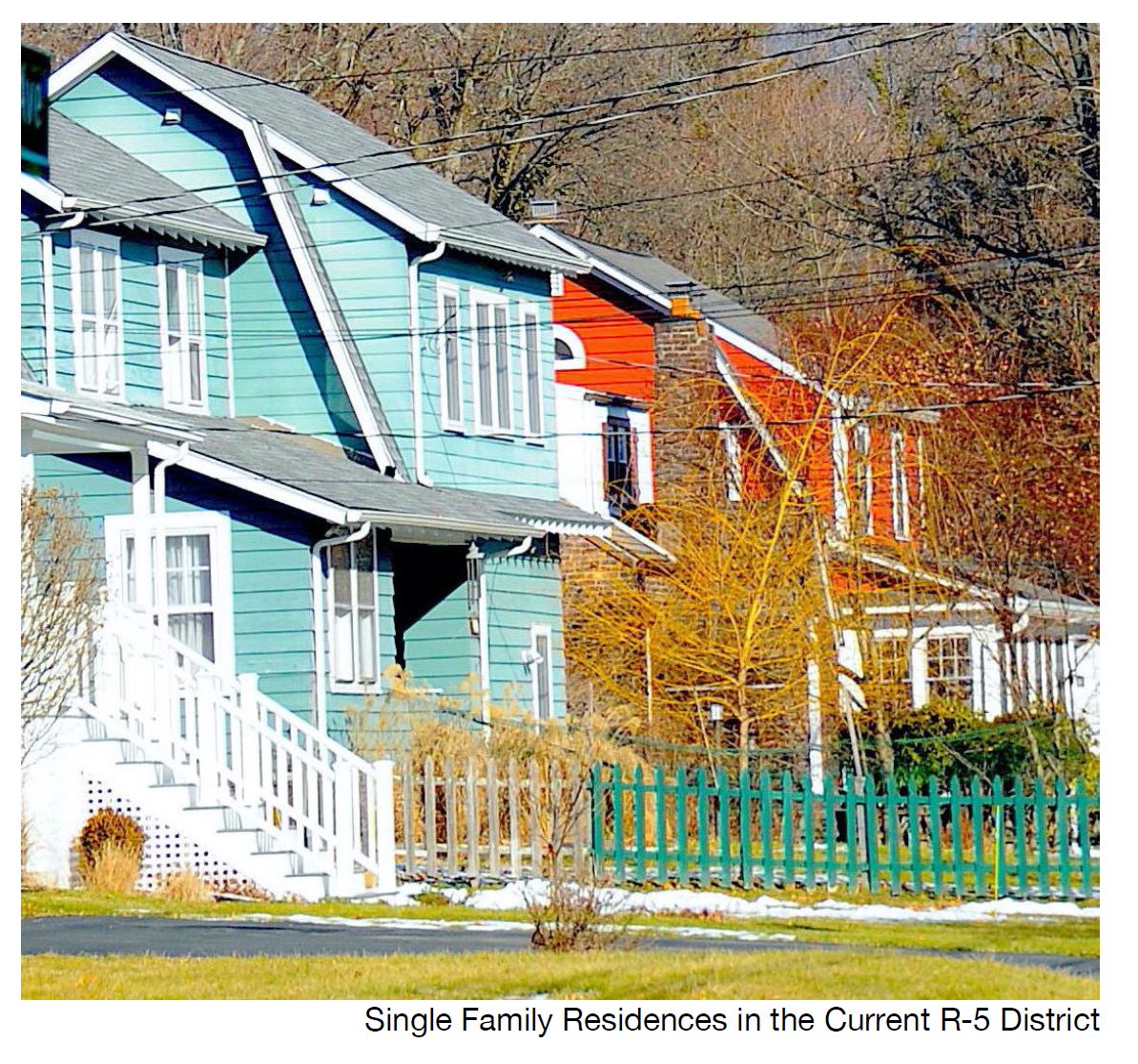
A significant surge in construction of new homes followed the end of the Second World War and the construction of the Tappan Zee Bridge, the New York State Thruway, and the Palisades Interstate Parkway in the early 1950s. Since that post war boom, a more modest process of selective infill development followed, continuing up to the present day. At the time of this 2020 update to the Comprehensive Plan Upper Nyack is substantially built out, with a few marginal undeveloped sites. However, there are numerous existing oversize properties that could potentially be subdivided under the present zoning.
Additional Historic Notes
Village Hall
For the first 15 years as an incorporated Village, the Village Board of Upper Nyack met at the home of the President or a Village Board Trustee. Then in 1887 the Village built a combination Village Hall and Firehouse, financed by a gift and/or loan from George W. Schuler, a resident who lived on the southeast corner of Broadway and Castle Heights Avenue. Sharing the building with Upper Nyack’s resident fire company, Empire Hook and Ladder Company #1, the Village Offices and Meeting Room were on the second floor of the building. Over time this second-floor location became increasingly difficult and in 1973 the Village acquired and renovated the building next door, dedicating it that year as the new Upper Nyack Village Hall. Empire Hook and Ladder Company #1 was given full use of both floors of the former combined Village Hall and Firehouse building.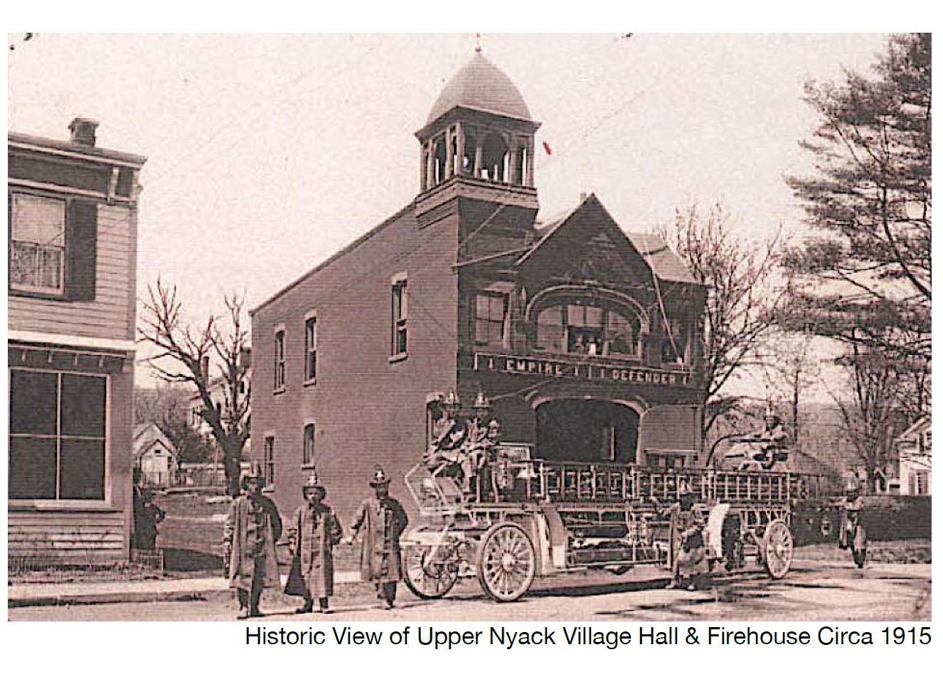
Empire Hook and Ladder
Upper Nyack’s resident fire company, Empire Hook and Ladder Company #1, is older than the incorporated village, having been founded in 1863. Using horsedrawn trucks at first, it acquired its first motorized truck in 1916. As noted above the fire company occupies the Upper Nyack Firehouse, the brick building that once also served as Upper Nyack Village Hall. Throughout its history, the fire company was supported by the Village and functioned as part of the Nyack Fire Department until early 2000 when it became part of the new Nyack Fire District.Schools
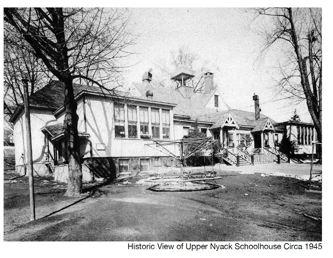
As early as 1797 there was a small log schoolhouse in Nyack on the north side of the “lane”, now Main Street, east of Broadway, where a majority of the 15 students were Smiths, Palmers, and Van Houtens from Upper Nyack. A school district corresponding to the present Upper Nyack was formed in 1844 and a schoolhouse measuring 18 feet by 26 feet was built on a tiny lot located above the Upper Nyack Brook on the south side of Old Mountain Road east of Midland Avenue. In 1885 the school district built a new two-room school at the head of School Street just north of Highmount Avenue.